ESurveying developed ESurvey KML to convert maps easily
By Edit Team | June 21, 2014 6:32 am SHARE
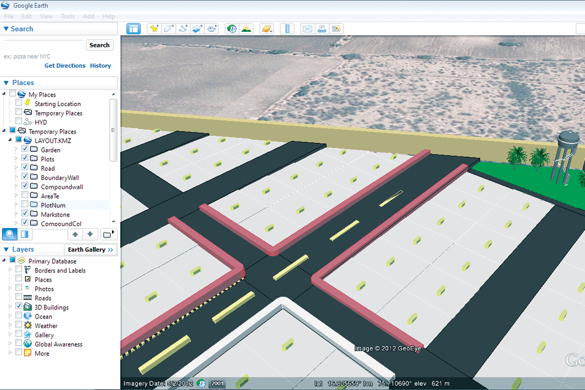
Google Earth and AutoCAD drawing
Google Earth implementation has brought in a new dimension for visualisation of earth surface. This created the opportunity for civil engineers to present their data in geographic coordinate systems. Mostly, civil engineers display their information for clients with maps and two-dimensional graphics (cartesian coordinate system), either on paper or digitally. With Google Earth there is a way to represent two-dimensional drawings in three dimensions, with an understandable backdrop of earth image. This has enabled civil engineers with a greater opportunity to make it more understandable and impress clients.
With simply powerful interface, Google Earth combines and displays stunning graphics and a planet full of data to which anyone may add information and share that information with the rest of the world in just a few clicks. In a very short time Google Earth became very popular (more than 1 billion downloads) because of its simplicity and power. It is simple to use yet highly stable.
Civil engineering drawings such as survey maps use cartesian coordinate system to represent a point. Google earth on the other hand uses WGS84 map datum to represent data. To make drawings compatible with Google Earth a geodetic transformation is required.
KML file
Google Earth can open documents called Keyhole Markup Language (KML) documents and overlay the content on available world imagery. KML is a simple text-formatted syntax that provides basic information regarding location, data type (points, lines, polygons), symbology, and attributes.
ESurveying develops solution for land surveying requirements such as contouring, earthwork, cross section and longitudinal section. Engineers at ESurveying have now developed a solution to port data between AutoCAD and Google Earth, named as ESurvey KML. ESurvey KML can convert KML file into AutoCAD drawing and viceversa.
Survey engineers can now convert their map drawings easily as a Google Earth KML file and open it in Google Earth. This helps in cross checking the survey data. ESurveying has also developed another free solution using which elevation data from any point on earth surface available in Google earth can be extracted. Using this software even simple 2D drawing developed in AutoCAD can be represented in 3D on Google Earth with simple steps. The pictures represent 3D KML files created using ESurvey KML.
With release of ESurvey KML it has become very easy to convert any survey drawing (road, railway, irrigation, canal, layout, city map) to a KML file that can be opened with Google Earth Geo browser. When any survey drawing is seen in relation to imagery and terrain, it becomes very easy to understand the drawing.
Cookie Consent
We use cookies to personalize your experience. By continuing to visit this website you agree to our Terms & Conditions, Privacy Policy and Cookie Policy.


