Major challenges were frequent landslides/rockfalls in Uttarakhand due to the adverse geological and topographical conditions accompanied by heavy rainfall. Also, the investigation area Chamba region, falls in Zone-IV of seismic zoning map of India.
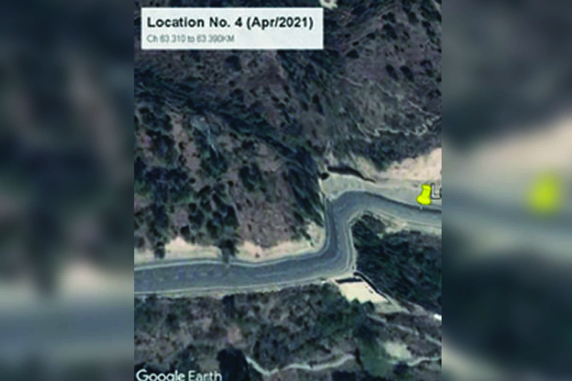
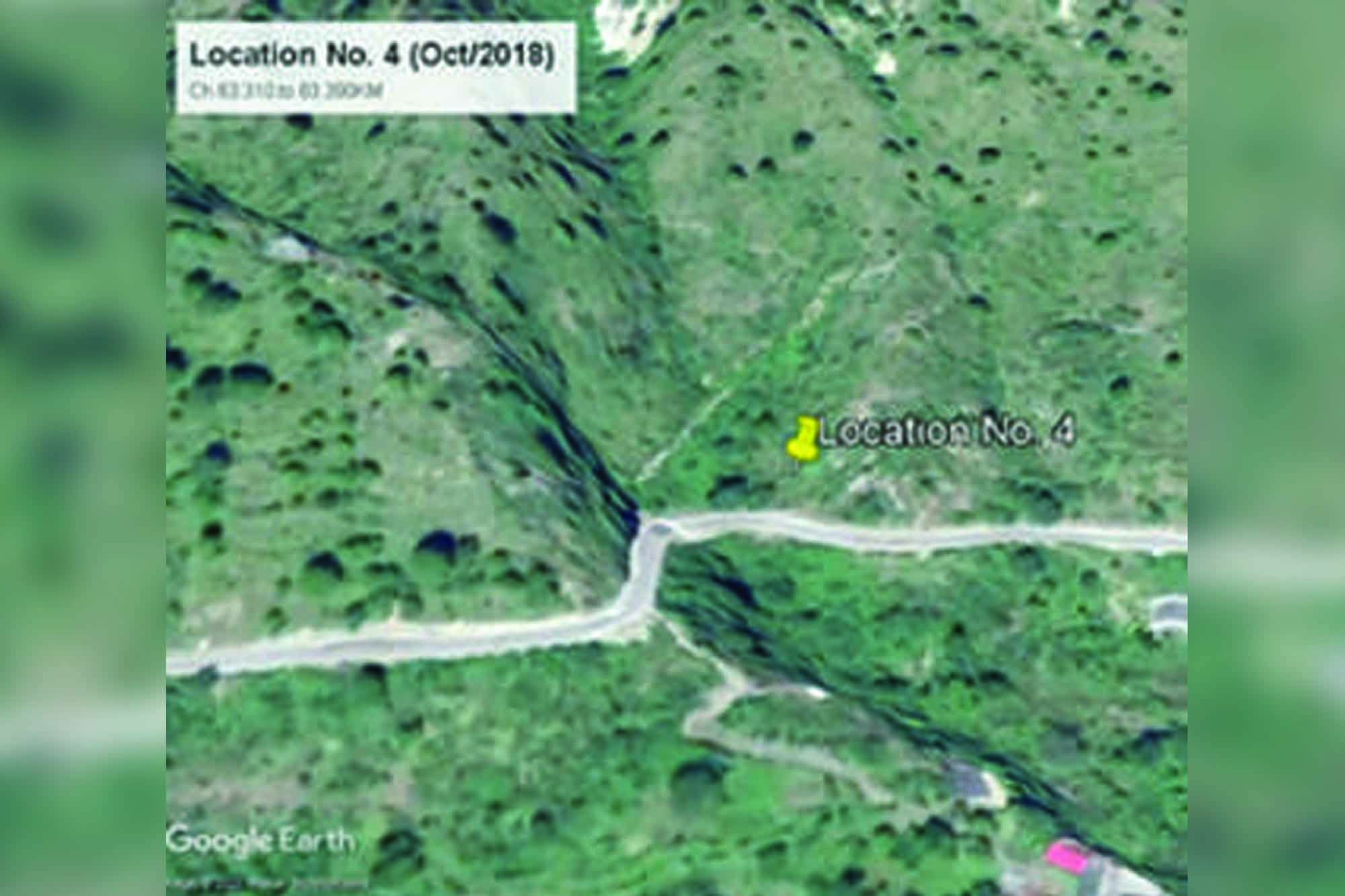
Landslides, being critical, are very common in hilly region and is influenced by several parameters. The frequency of landslides is increasing nowadays due to more and more human interventions. The Himalayan region is more vulnerable due to its dynamic nature, complex geology, young rock mass, heavy rainfall, and climate change. Heavy rainfall creates a great problem in various parts of the Himalayan region in the form of landslides and subsidence, directly impacting road traffic. The economically and strategically important project, i.e., the Chardham Highway Development Project, was announced to improve the connectivity of four holy Hindu shrines: Kedarnath, Badrinath, Gangotri, and Yamnotri. In this project, the roads will be upgraded and developed by connecting all four dams. During the widening of roads to two lanes, some areas are prone to sliding due to geology, geomorphology, rainfall, and other reasons. The slide locations are located about 2.3 km after the North Tunnel Portal, Chamba, Chamba to Dharasu Highway (NH-34) between 63.310 and 63.390 km. The area is covered by low to moderate vegetation. The angle of the slope ranges from 500-700, and a seasonal nala is present on the western side of the slide zone and passes all along the slope towards the east direction.
Project challenges
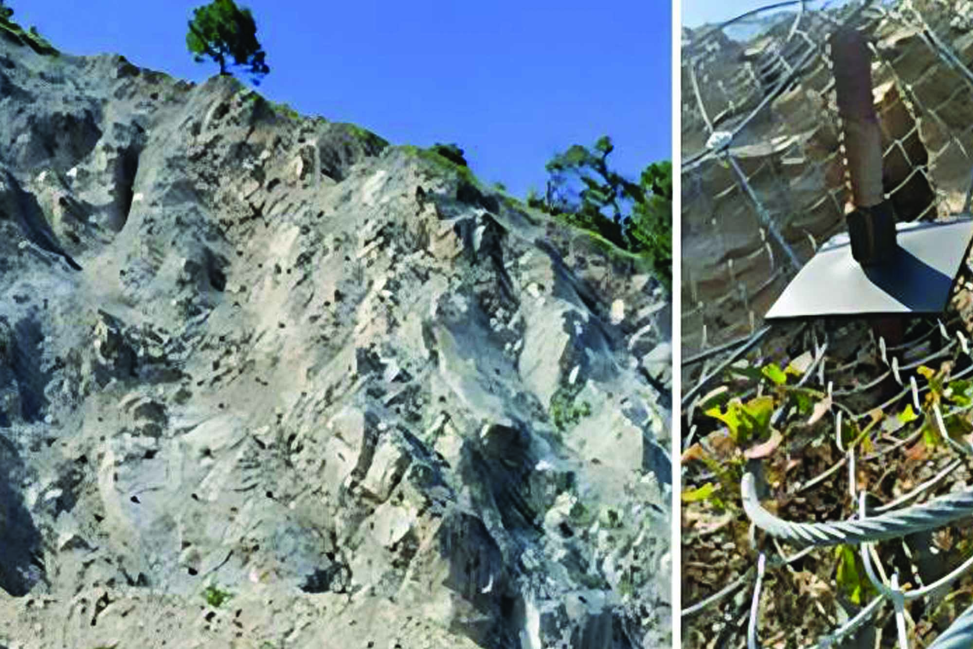
The stability of the slope mass has been compromised during the expansion of the existing NH-34, primarily due to the cutting of the toe portion. This has resulted in a steeply cut slope, towering at a height of approximately 40-50 meters, lacking any intermediate benches for support. Additionally, the area is vulnerable to heavy rainfall and seismic activity, as it is located within Seismic Zone-V. The presence of closely spaced joints, which dip in the opposite direction of the slope at the top, raises concerns of potential toppling failure owing to the steep slope cutting.
Solution proposed
Slope stabilisation measures are required to be provided on the hillside slope. Several slope stabilisation measures are Earth Works (excavations near the crown of the landslide and filling near the toe of the landslide), Buttress Fills, Retaining Walls (Gravity Walls, Reinforced soil walls/slope, and Soil Nailing/ Ground Anchors), Reinforcing Piles, Gabion wall etc. At the present location, the following solutions were proposed:
1. Loose scaling/trimming in isolated patches of unstable blocks or steep profiles as per site conditions.
2. Due to space restrictions on the hillside and valley side, Self-Drilling Anchors (SDA) of 6 m length spaced at 2.5 m c/c in both directions for a height of 47.5 m above the existing wall are proposed. The soil anchors shall function as passive mitigation measures to address global instability.
3. Considering the terrain and location of the project, it has been proposed to provide the flexible fascia, i.e., high tensile steel wire mesh (Techrhombus as a Primary mesh and Double twisted wire mesh as a secondary mesh) for the exposed slope surface.
Execution at the site
The project involves steps, starting with excavating or scaling to the specified levels and slopes as indicated in the drawings. This is followed by the drilling and installation of Self-Drilling Anchors (SDA), combining rotary percussive drilling with continuous grouting to minimise ground modification and disturbance. To effectively contain the grout, drill holes are typically inclined at about 10 degrees to the horizontal, sloping downwards.
Grout injection is executed through a hollow steel bar, with the injection mixture flowing through holes in the sacrificial drill bit, thereby stabilising the drilled hole. To install the DT Mesh, rolls are transported to the top of the slope using a crane, winch, or ropeway system. These rolls are then aligned along the upper edge, opened, and extended for the designed runout length before being laid into trenches over the anchors.
Adjacent meshes are connected using a looping or ring system. The installation of TechRhombus Mesh incorporates High Resistance Clips (HRC). This mesh features top and bottom cables made of steel, galvanised with a Zn-Al alloy. The meshes are unrolled to the required length, with base plates fixed over the anchors and mesh and then tightened.
After any rockfall event, periodic maintenance is crucial. This includes clearing debris from the draped mesh and checking all connections, ideally every six months, to ensure stability and effectiveness.
Conclusion
Under this project, stabilisation measures such as scaling overhang rock cliffs and applying a high-tensile rolled cable net with SDA have been envisaged without affecting existing structures, the environment, and the forest within the area. The protection is serving as desired by the authority. After stabilising the affected vulnerable stretch of this road, uninterrupted traffic flow would undoubtedly augment the regular movement of locals & by-passers for their daily requirements in the region, which will naturally upgrade the economic conditions of the people in the area.
For further details, please contact:
TechFab (India) Industries Ltd.
Head Office: 46 & 47, Maker Chambers VI,
Nariman Point, Mumbai – 400021
Email: info@techfabindia.com,
Website: www.techfabindia.com
Cookie Consent
We use cookies to personalize your experience. By continuing to visit this website you agree to our Terms & Conditions, Privacy Policy and Cookie Policy.